Show the map
Trail de la Vinière 2017
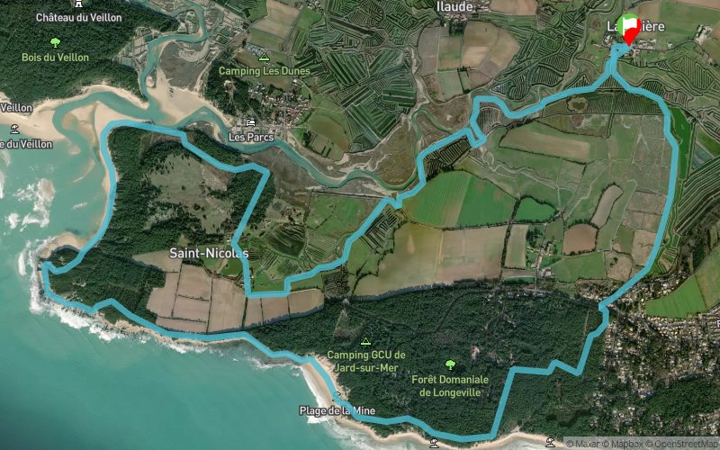


15.1 km
70 m
70 m
 Jard-sur-Mer (85)
 Points of Interest table
| Accum. | Intermediary | |||||||
|---|---|---|---|---|---|---|---|---|
| POI | Description | Alt. | Dist. | D+ | D- | Dist. | D+ | D- |
 Competition organized on 08/20/2017
Trace n°33547
Ascent threshold : 0 m Distance threshold : 30 m Smoothing : Yes Origin of altitudes : MNT Aster GDEM
Ascent threshold : 0 m Distance threshold : 30 m Smoothing : Yes Origin of altitudes : MNT Aster GDEM
Loop
Dominant terrain : Path
Max alti. : 25 m
Avg alti. : 9 m
Min alti. : 5 m
Longest ascent : 20 m
Longest descent : 70 m
Dominant terrain : Path
Max alti. : 25 m
Avg alti. : 9 m
Min alti. : 5 m
Longest ascent : 20 m
Longest descent : 70 m
Elevation profile
More tools
Create a new roadbook page
Map and track on your website
Warning ! When you insert a Trace de Trail map on your website, you agree not to hide any element of the module (links to Trail Trail or Trail Connect banner)
Add a realisation
Validate
Add a realisation to share your chrono and describe the conditions that you encountered during you trail running !
Add a comment
Validate
joelbatard
28/11/21, 22:03:21
Je ne suis pas sur qu'elle soit encore réalisable, beaucoup de portail et de barbelé à franchir sur ce tracé
28/11/21, 22:03:21
Je ne suis pas sur qu'elle soit encore réalisable, beaucoup de portail et de barbelé à franchir sur ce tracé
Show the infos
Add a track